
Plan, target, and measure vehicle-based DOOH using GPS, geofences, camera sensing, geo-time triggers, and live optimization.
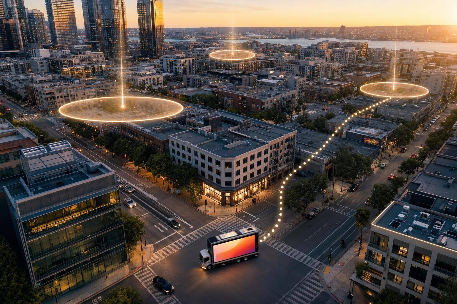
Location-based DOOH works best when you tie place, time, and proof of delivery to one clear goal. If I were setting up a vehicle-based campaign today, I’d focus on four things first: where ads run, when they trigger, what data controls delivery, and how results are measured.
Here’s the short version:
A few numbers stand out right away:
If you buy, sell, or manage vehicle-based media, the core idea is simple: use location signals to control delivery, then use playback and outcome data to check if the campaign did its job. That means matching the setup to the goal, whether you want awareness, store visits, app downloads, or purchases.
What this guide covers, in plain English:
One fast way to think about it: fixed screens are tied to a place; moving screens follow people through places. That shift changes planning, delivery, and reporting from the ground up.
The rest of the guide breaks that down in a simple way so I can move from setup to measurement without guesswork.
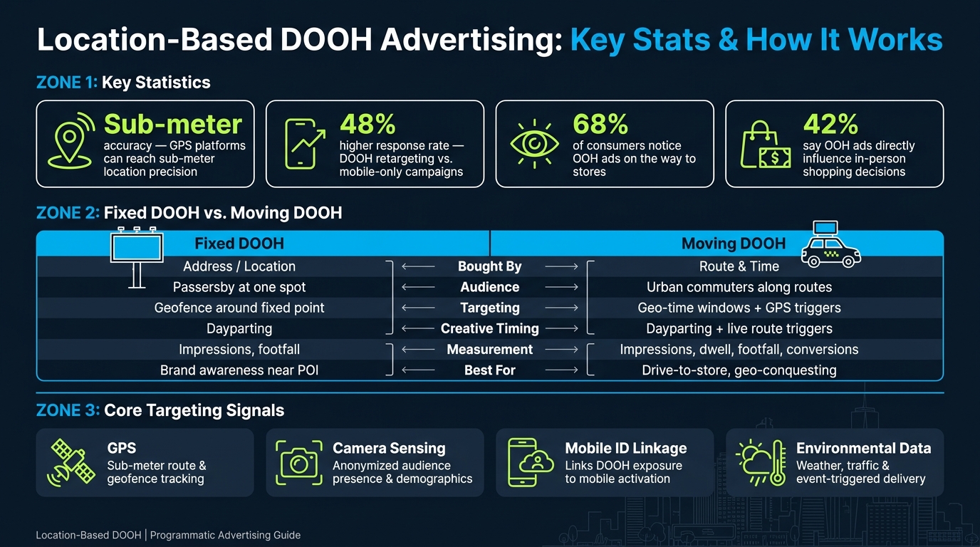
Fixed vs. Moving DOOH: Targeting, Measurement & Key Stats
Digital out-of-home (DOOH) means digital screens placed in public spaces. Programmatic DOOH (pDOOH) adds automated buying, live control, and location-based rules. In pDOOH, location isn’t just a data point. It helps decide if an ad shows at all.
Moving DOOH includes vehicle-based inventory like taxi tops, rideshare rooftop screens, and in-vehicle tablets. Fixed screens stay tied to one address. Moving screens don’t. Audience exposure shifts based on the route a vehicle takes and its street-level position at any given moment. That changes how campaigns are planned, bought, and measured.
Fixed DOOH is bought by place; moving DOOH is bought by route and time.
Location is the trigger that decides whether an ad runs. The data starts to matter when it’s turned into delivery rules based on geography, time, and context. Campaigns can be set up across several geographic levels, including:
Geography is only part of the setup. Time and local conditions sit on top of it. Dayparting limits delivery to set hours, while live triggers can react to weather, traffic, and local events.
For moving inventory, geo-time windows use high-resolution GPS to trigger ads when a vehicle enters a target area during a set time window. For vehicle-based screens, those rules decide when a screen enters, exits, or stays within a target zone.
Rooftop screens and in-vehicle tablets send different kinds of signals. Rooftop LED displays focus on street-level exposure. They reach pedestrians, drivers, and city audiences as vehicles move through target zones. In-vehicle tablets hold passenger attention for longer periods, which makes them a strong fit for interactive responses and deeper engagement. Platforms like Enroute View Media support both formats, combining rooftop LED screens, in-taxi tablets, and geo-time activation in one programmatic workflow.
That matters in practice because route, dwell, and proximity become the audience signals used to set up the campaign.
Once location rules are set, the next move is picking the signals that control when ads play and who is likely to see them. In vehicle-based campaigns, that usually comes down to three main inputs: GPS, front-facing cameras, and cellular connectivity.
GPS is the starting point. Systems using up to 41 satellite channels can reach sub-meter precision. That level of accuracy supports geofencing and route tracking, which is a big deal when a campaign depends on exact movement through a city.
Front-facing cameras add another layer. They can confirm audience presence and infer anonymized age and gender signals. That helps advertisers move past simple location data and make ad delivery more specific.
Then there’s mobile ID linkage. This connects DOOH exposure to mobile activation. And the payoff can be strong: research shows retargeting after DOOH exposure can produce a 48% higher response rate than mobile-only campaigns.
Each signal has a job to do, but none is perfect. Here’s the trade-off at a glance:
| Data/Signal Type | Strengths | Limitations | Privacy Consideration |
|---|---|---|---|
| GPS (Satellite) | High precision (<1 meter); essential for geofencing and route tracking | Can be affected by urban canyons or tunnels | Tracks the vehicle, not the individual |
| Camera-Based Detection | Real-time age, gender, and presence insights | Requires specific hardware; cannot analyze individuals under 18 | Must be GDPR-compliant; no identifiable footage stored |
| Mobile ID Linkage | Links DOOH exposure to mobile activation; requires DSP integration; opt-in IDs only | Requires integration between OOH and mobile DSPs | Phone IDs require opt-in data handling |
| Weather, traffic, and event data | Adds context to delivery | Requires real-time data feeds and programmatic integration | Low risk; based on public or environmental data |
A good CMS matters here too. You want one that can push updates within minutes, so your creative and targeting rules don’t lag behind what’s happening on the street.
After you know which signals you trust, the next step is turning them into targeting rules that fit the campaign goal.
For broad awareness, DMA- or city-level targeting usually does the job. If the goal is tighter local relevance, geofences or custom polygons make more sense. Those can be built around stores, competitor sites, or event areas.
With vehicle-based inventory, geography works best when paired with time. That’s often where campaigns start to feel smart instead of blunt. A lunch offer, for instance, might run only when a vehicle enters a downtown zone between 11:00 AM and 1:30 PM on weekdays. A retail brand might draw a geofence around a competitor’s store and serve ads as soon as the vehicle moves into that area. Camera-based sensing can also trigger creative for a defined audience segment.
| Targeting Method | Use Case | Required Data Input |
|---|---|---|
| DMA/Regional | Broad brand awareness across a metro area | City-level inventory availability |
| Geofencing/Polygon | Competitor proximity, POI targeting, and event zones | GPS coordinates and virtual boundary setup |
| Geo-time targeting | Time-sensitive promotions | GPS plus real-time clock triggers |
| Demographic Sensing | Age- or gender-specific creative delivery | Front-facing camera data or third-party segments |
| Environmental | Weather-, traffic-, or event-triggered ads | External API feeds for weather, traffic, and event schedules |
The pattern is pretty simple: match the rule to the business goal. If the offer depends on where someone is, use geography. If it depends on when they’re there, add time. If the message should shift by audience type, bring in sensing or segment data.
pDOOH campaigns are usually bought on a CPM basis through a DSP. Dynamic CPMs and automated bidding shape media delivery, with DSPs triggering ads when a vehicle enters the target zone during the active time window.
In practice, budget planning often follows zone logic. Cities are split into high-traffic areas, such as airports, and pricing shifts based on route traffic and event activity. That means media spend tends to flow toward places and time periods where exposure is more likely.
One of the clearest checks on campaign setup is the playback report. If the system is working as planned, those reports will show timestamps, GPS coordinates, and ad duration. Those logs become the backbone for the measurement metrics covered in the next section.
These rules matter most when the screen is moving, because the audience can shift minute by minute. In vehicle media, the route drives ad delivery in real time.
A taxi entering an airport pickup lane at 6:00 AM can trigger one ad, while that same vehicle moving into a nightlife district at 10:30 PM can trigger another. One vehicle can reach very different audiences based on route, time of day, and dwell state. Premium zones can also trigger different creative and higher bid values.
Traffic jams can work in your favor. Congestion creates dwell time, which gives longer video more room to play. When the vehicle is in motion, shorter spots work better: about 10 seconds for static and 20 seconds for video.
Geo-conquesting is another practical use of live positioning. If a vehicle passes within walking distance of a competitor's store, the system can trigger an ad for the advertiser's nearest location. You can't do that with a fixed billboard.
Routes to retail matter too. 68% of consumers notice OOH ads while en route to retailers, and 42% say OOH ads directly influence their in-person shopping decisions.
That starts to work in practice when route data, screen type, and CMS controls line up.
Enroute View Media uses route, time, and zone data across taxi and rideshare fleets.
The platform runs on two hardware layers:
A cloud CMS handles scheduling, playlists, and geofencing across city zones. Fleet operators can set premium zones and apply dynamic CPMs that change as vehicles enter those areas. Reporting includes GPS timestamps and playback verification, which lets operators confirm when and where each ad ran.
Programmatic SSP integrations also fill unsold inventory automatically.
"enRoute partnership has helped us scale faster, more efficiently, and cost-effectively." - Sebastian, CTO, Aceme
Once a campaign goes live, measurement is where location data starts to earn its keep. It turns movement and exposure signals into proof that the campaign did what it was supposed to do.
Start with exposure. Use GPS, sensors, and play logs to confirm who actually saw the ad. Each verified exposure should be counted on its own. That gives you a clean view of delivery and helps show whether your location rules and audience signals worked the way you planned.
The right metric depends on the goal.
| Metric | Data Source | Fixed DOOH | Moving DOOH |
|---|---|---|---|
| Impressions | Sensors / GPS / Loop logs | High-traffic static locations | Exposure along active routes |
| Unique Reach | Camera / Mobile signals | Broad brand awareness | Targeting diverse urban commuters |
| Footfall | Geofencing / GPS | Directing traffic to nearby stores | Drive-to-store visits near route POIs |
| Dwell Time | Session logs / Sensors | Waiting areas (transit hubs) | Captive audiences inside taxis/rideshares |
| Conversions | QR Codes / NFC / APIs | Immediate local offers | In-transit e-commerce or app downloads |
| Sales Lift | Transaction data / Surveys | Store sales near the screen | Correlating route density with store sales |
After you’ve confirmed exposure, use what you learn to adjust budget, zones, and creative. That’s where reporting stops being passive and starts helping the campaign perform better.
Live campaigns need live tuning. If you wait until the end, you miss the chance to fix what’s not working and put more money behind what is.
There are four main levers you can pull:
Use live results to tighten delivery while the campaign is still running.
Start with the business goal. Then line up the location data, the creative, and the metric to match it.
Impressions matter, but they’re only part of the story. Footfall, sales lift, and QR conversions show whether the campaign drove action. That’s the difference between a campaign you can learn from and one you can only summarize.
The strongest campaigns use location data not just to show value, but to get better as they run.
Moving DOOH is measured with the vehicle’s onboard GPS location at the exact moment each ad plays, paired with playback checks like timestamps, GPS-based location data, ad duration, and impressions.
That matters because moving screens don’t sit in one place. So instead of treating each vehicle like a fixed billboard, geo-time targeting lets advertisers serve ads with less than 1 meter of precision from the intended target.
You need accurate GPS location data to set tight geofences and line them up with specific day-and-time windows. The campaign also depends on live connectivity, like LTE/4G, so schedules fire at the right moment and each play can be logged with a timestamp and GPS-based location.
If audience segmentation is part of the setup, the system also needs anonymized passenger-facing camera signals for live targeting. That can include data points like age, gender, or simple presence detection.
Start with software license costs per screen or device. In most cases, that lands around $5.99–$19.99 per month. On top of that, you may need to pay extra for white-labeling, programmatic integration, or custom development. Hardware is usually billed separately.
It also helps to budget carefully for delivery. New networks often begin with fill rates in the 20%–30% range, then improve over time. So when you run the numbers, leave room for the early ramp-up, shifts in market conditions, and changes in programmatic demand.
Need pricing details?
EnrouteViewMedia is a Canadian technology company based in Edmonton, Alberta, Canada. The company was founded by a group of media entrepreneurs and engineering executives. Our mission is developing leading-edge digital media display technologies for taxicab rooftops and taxicab interiors advertising market. Through our easy to use ad delivery and management system, we assist our clients in reaching their customers with targeted exposure. EnRouteViewMedia continuously strives to be the global leader in digital geo-time targeted advertising media systems for modern taxi fleets.